Satellite-backed well and grid context for spatial review.
FieldViewer
Digital field review for maps, wells, timelines, production, and AI-assisted technical context
FieldViewer is a web-based operations and subsurface review concept. It connects field maps, production history, well testing, completion context, status dashboards, and AI-assisted review workflows into a single browser experience.
Product modules
Brief, practical modules designed for field review and technical communication.
Interactive production bubbles, history, rates, decline context, and well profiles.
Daily field status, rigs, active wells, and operating summaries.
Trends, crossplots, bubble analytics, and map context for production tests.
Completion and pump-performance screens for deeper field review workflows.
Field-aware assistant workflows for selected wells, available layers, and management briefing material.
Screenshots and live paths
Click any image to open the corresponding live demo screen.
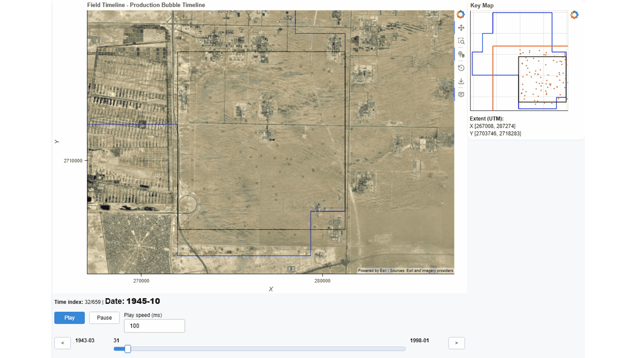
Timeline reviewProduction bubble timeline with ESRI imagery and key map.
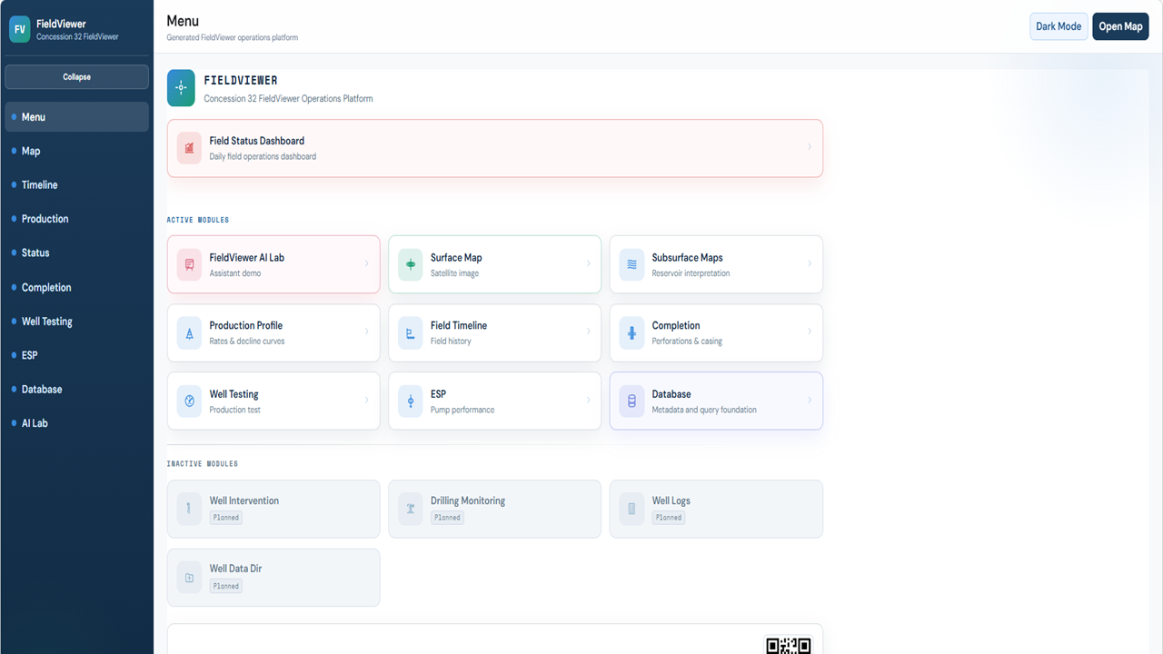
Demo menuEnterprise-style module launcher for the FieldViewer app.
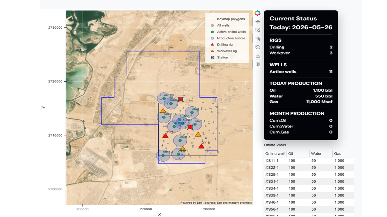
Field status dashboardDaily wells, rigs, production totals, and map review.
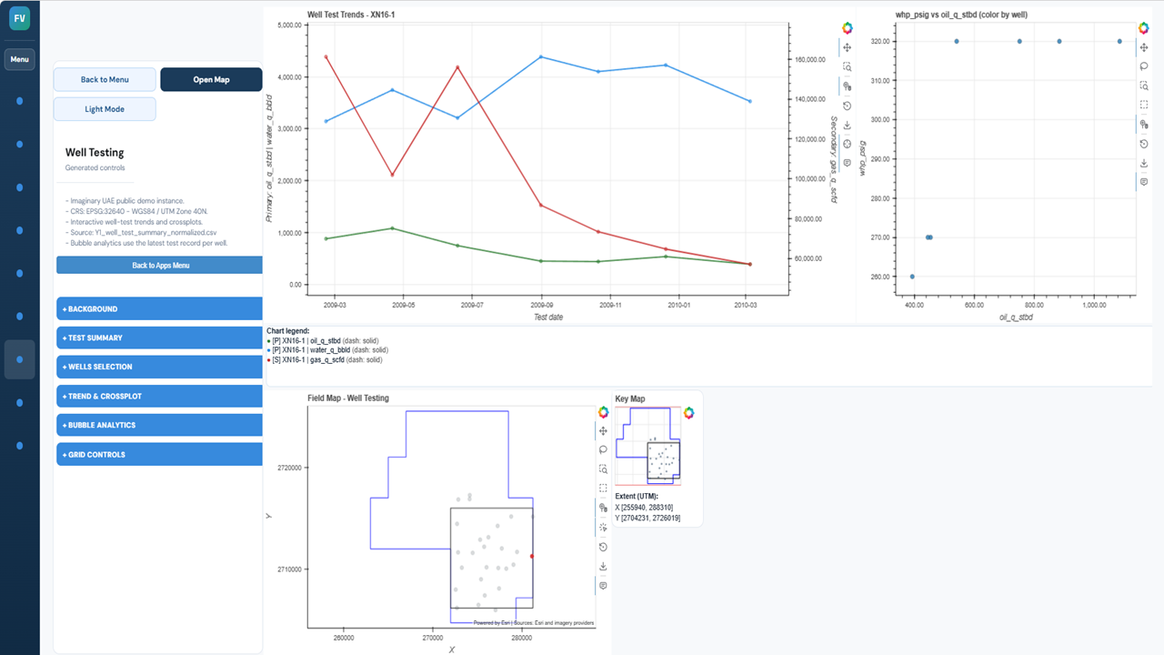
Well testingTrend charts, crossplots, bubble analytics, and map context.
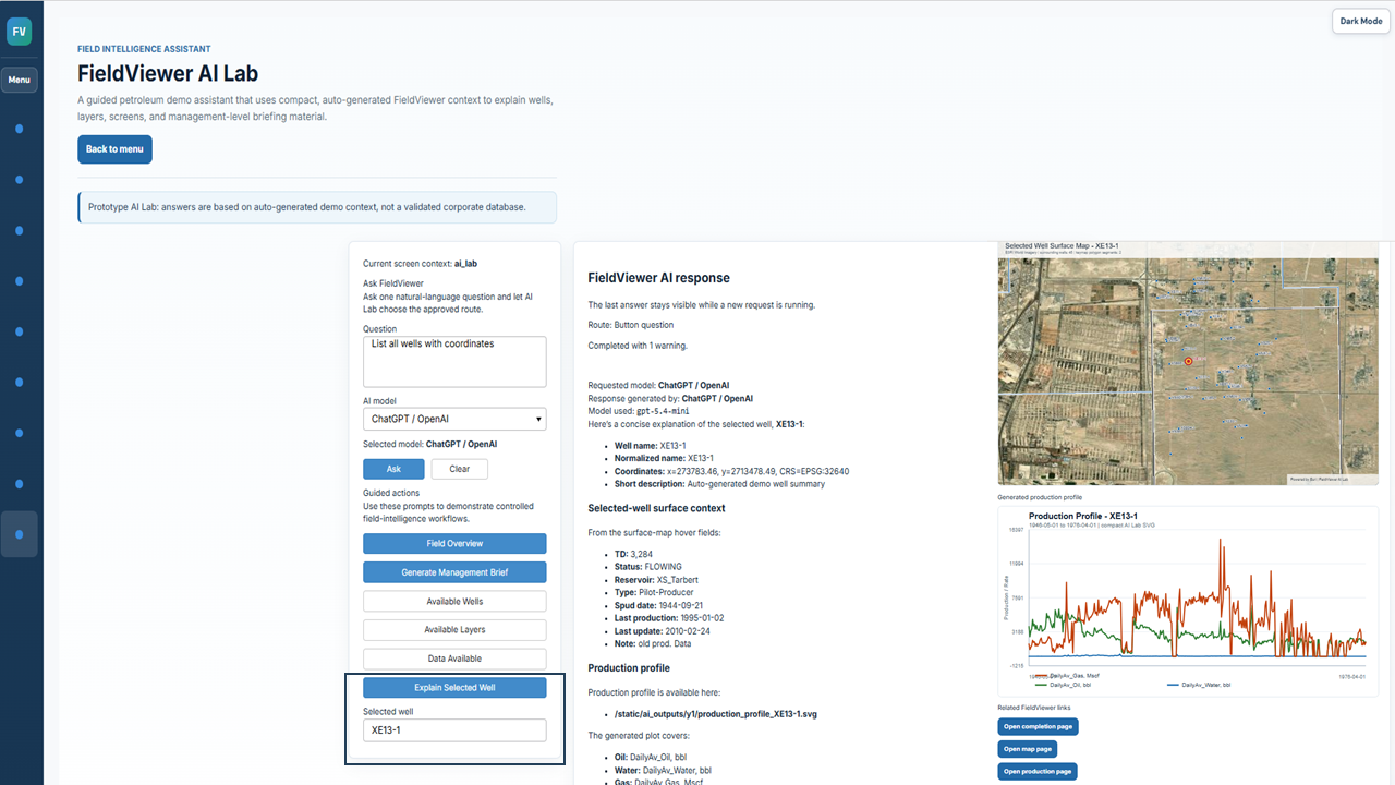
AI Lab and selected-well reviewAssistant response, surface-map context, and production profile presented together for faster technical review.